Map
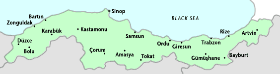
Northern Anatolian region along the Black Sea occupies 18% of the total area of Turkey with its 141.000 square kilometers (54.440 square miles) of land. This northern coastal region has a steep and rocky coast, and rivers cascade through gorges of the coastal ranges. A few of the large rivers, those cutting back through the Pontus Mountains (Dogu Karadeniz Daglari), have tributaries that flow in broad, elevated basins. Access inland from the coast is limited to a few narrow valleys, and, as a result, the coast has always been isolated from the interior. The population and cities are concentrated along the coast line.
The narrow coastal ribbon running between Zonguldak and Rize, widening here and there into fertile deltas, is an area of concentrated cultivation. All available areas, including mountain slopes wherever they are not too steep, are put to use. The mild, damp climate favors commercial farming, thus making the region heavily forested and rich in fauna and the flora with over 7.000 species of plants. Fishing, coal, nuts and tea growing are the major sources for local economy. Other important agricultural products are; corn, kiwi, rice, beans and potatoes. The western part of the Black Sea region also hosts much of Turkey's heavy industry.